
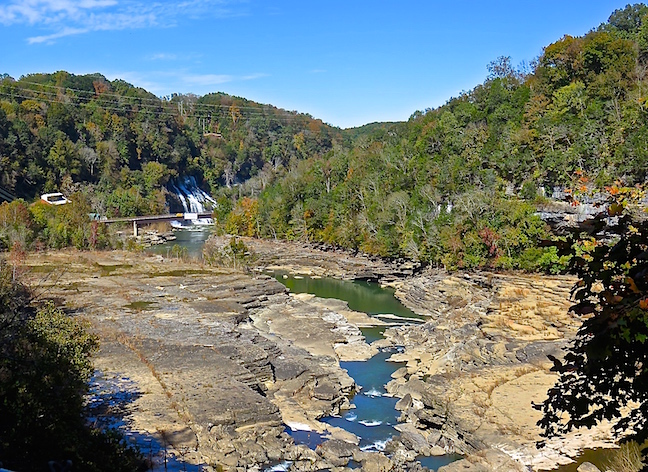
Up on Tennessee’s Eastern Highland Rim The Caney Fork, Collins and Rocky Rivers converge above the Great Falls Dam. Below the dam their waters have carved the beautifully-rugged Caney Fork Gorge. We visited during a low water release period and got to walk on the lake bed.
Water can be released from the Great Falls Dam at any time. There may, or may not, be a siren and or flashing lights to warn hikers in the gorge that floodwaters are on the way. There was no shortage of signs warning of the imminent danger.
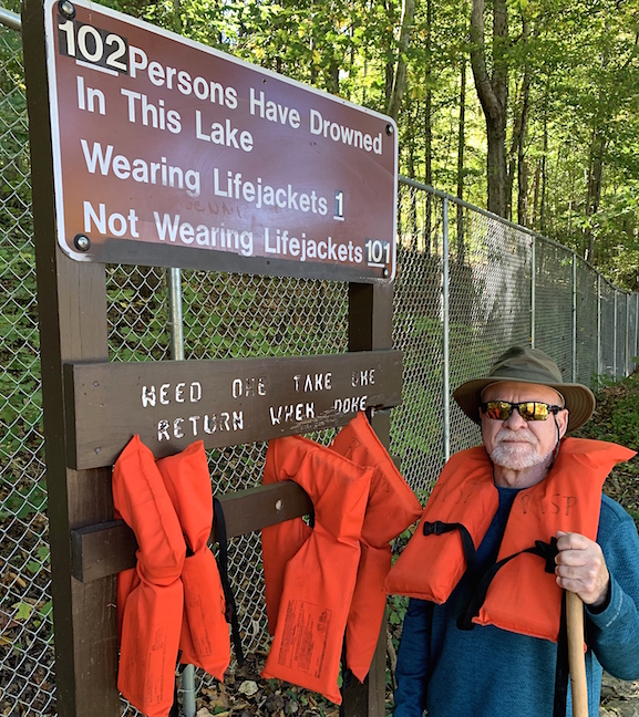
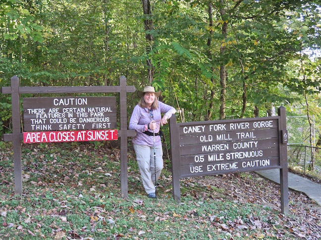
From the parking lot by the 100-year-old, textile mill it’s a short hike to lake level to view Great falls. 101 persons have drowned down there, so far. The life jackets were no joke.

Water ran in a constant stream down the steep, rock steps of the Old Mill Gorge Trail making them slick and precarious. Countless cascades flowed into both sides of the ravine along its entire length. The never-ending inundation by various water sources added to the surprise factor of flash flooding without warning.

Below the dam, Great Falls would normally thunder over the 30-foot tall, horseshoe in the background. The mighty cascade was subdued when we viewed it from the dry lakebed.
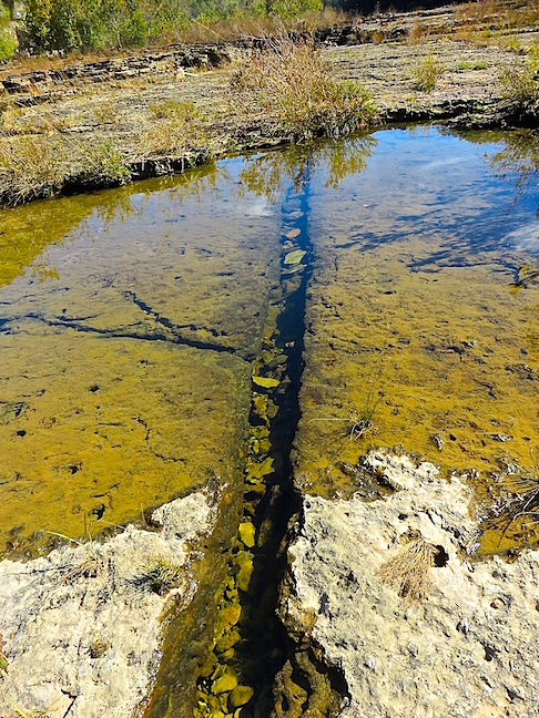
This fissure ran through the limestone bedrock for 100 yards in both directions. It was the perfect example of how the raging waters that course through the gorge carve it to pieces.
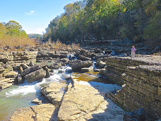
Exploring the water-ravaged riverbed was surreal. Especially, knowing that the fierce currents that carved the rocks could be released at any moment. During high-water releases, where Karen stands in the above picture could be 20-feet underwater.
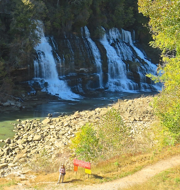
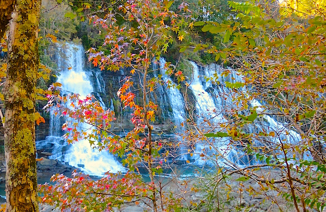
At 80-feet tall, Twin Falls is the largest cataract in the Park. It can range from 50- to 100-yards wide. The red sign at the trailhead forbids swimming and warns of sudden flooding.
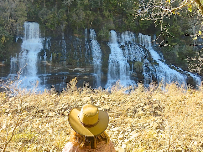
We ate lunch on the limestone cliff across from Twin Falls. It was hard to picture the dry riverbed below covered with ten feet of raging current.
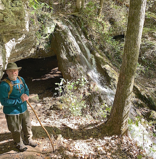
Exploring the unique cascades along the Downstream Trail below Twin Falls was astonishing. This double-channel stream down a limestone face with a cave behind it traveled over 100-feet before reaching the bottom of the gorge.
Due to the constant fluctuations in water levels and intensities, Rock Island State Park is constantly changing and offers a different experience with each visit. We plan on timing a trip back after heavy rains to see the gorge at full capacity. Of course, we’ll post pics and the story for you to enjoy at home.