
Karen and I were showing pictures of Piney Falls to the beerista at Monkey Town Brewing Company in Dayton, TN, where the Scopes Monkey Trial took place. She was impressed and surprised to hear Piney Falls was just 30 minutes away. She said, “I always go to Laurel Falls ’cause they’re right up the road.” We immediately put it on our list.
The Laurel-Snow trail was Tennessee’s first designated National Recreation Trail. In the late 1800s there were 7 major coal mines, 375 coke ovens, 2 blast furnaces, 17 miles of railroad and 200 employee houses in or around the 2,259-acre Natural Area. When the coal mining and logging played out, the land was repurposed for leisure activity.
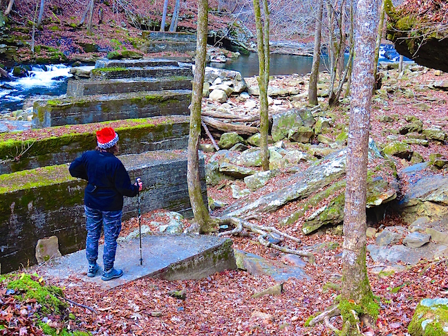
Many of the Ashler masonry walls and bridge supports from the 1800s are still standing.
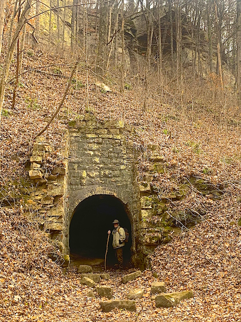
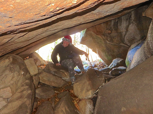
The abandoned Richland Mine is enticing, but cave-ins have reduced the deep mine to crawl-space height just past the entrance.
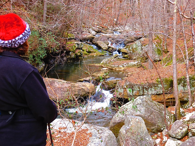
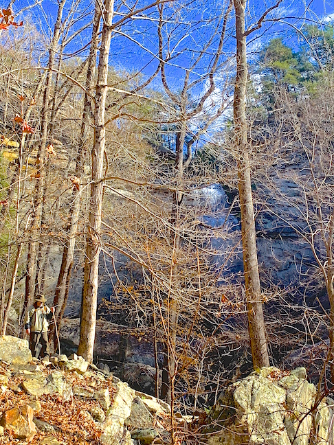
The first 1.5-miles of the trail are easy walking along Richland Creek. The last 1.8 miles to Laurel Falls are a series of steep switchbacks. The massive boulders strewn about the many creeks and rock slides from the gorges’ steep sides are amazing.
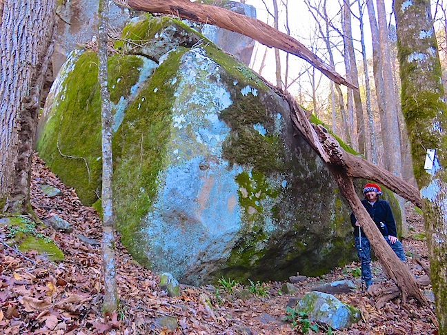
Boulder hopping and technical rock climbing are popular throughout this area. We found it impossible to capture the humongous scale of these rocks. Much of nature’s best works can only be appreciated in person.
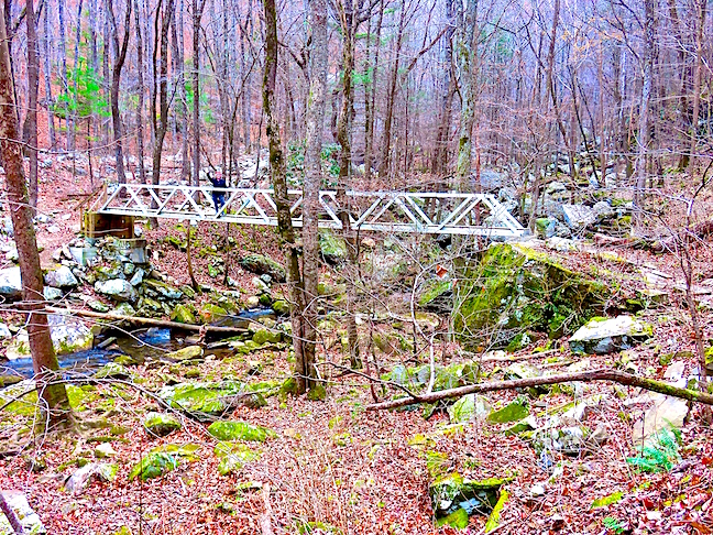
The 150-foot bridge over Henderson Creek looked fairly new. Its stout construction was impressive and will probably outlast us all. Across this bridge is a fork in the trail. Right will take you to 80-foot Laurel Falls. The left fork goes to 35-foot Snow Falls.
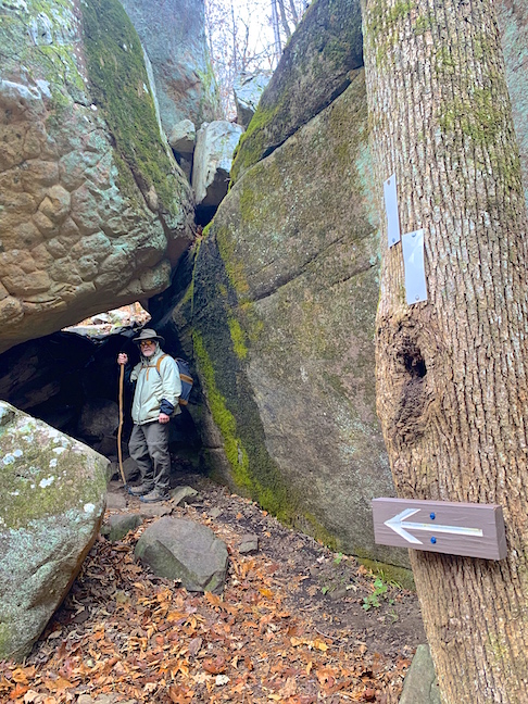
As we worked our way up the gorge, the boulders got bigger and became unavoidable in places. Extra white blazes and arrows were needed on this section of the hike to keep trekkers from losing their bearings.
Boulder-butt-scooting is required to transit this steep pass through the giant rocks.
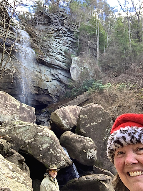
The sound of Laurel Falls pounding ginormous, granite boulders that calved off the escarpment walls, encouraged us as we picked our way through heavy rubble to reach the base.
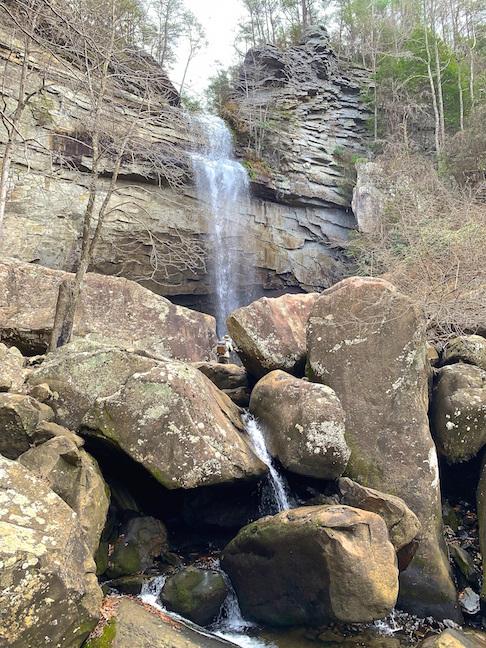
The plunge pool at the bottom of Laurel Falls was surrounded by massive stones. Karen chose not to boulder hop with me to a break in the barricade where I was dwarfed by the enormous rocks.
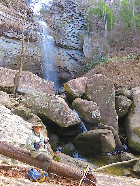
Lunch on a log is always more comfy than sitting on a rock. this deadfall made a fine bench with an incredible view.
The first half of the Laurel Falls hike was mostly flat and easy. The ruins from the 1800s, giant blue holes in Richland Creek, monumental boulders and small creeks cascading down steep slopes to cross the trail make just walking this portion of the path worthwhile. For the fitter and more adventurous, the extra two miles up precipitous switchbacks to Laurel Falls is worth sore legs and backs. The added four miles, one way, to Snow Falls is sure to be spectacular as well, but it was more than we were up for on this outing.