
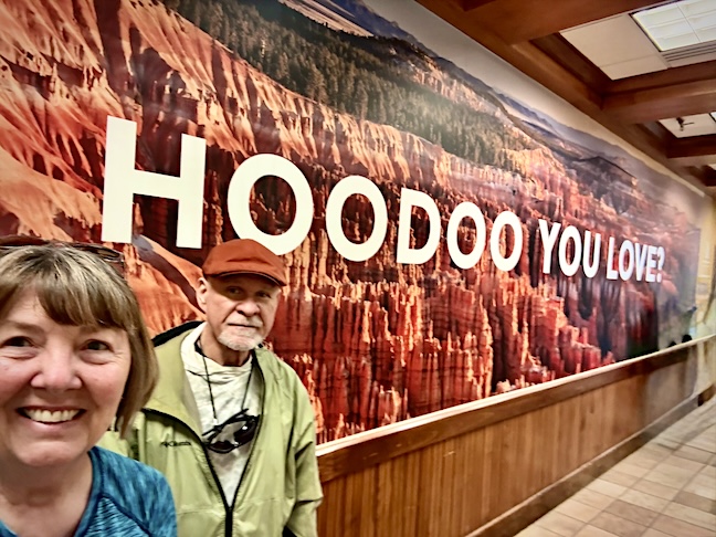
During our eleven-day journey in April to visit friends, family, and the western national and state parks, we never stayed in one place more than two nights. After saying goodbye to Mike and Amy in Zion National Park, we drove to Bryce Canyon City to explore the nearby National Park.
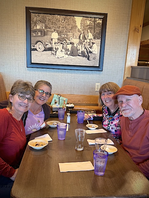
After checking into our hotel, we met Deke and Deb for dinner. Deke and I got to reminisce about our time spent at Snow Mountain Ranch 43-years ago, and we all shared some highlights of our lives during the missing decades. We would enjoy one more dinner together before moving on.
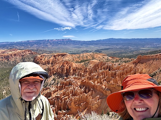
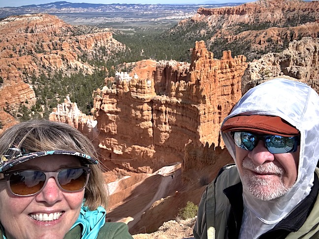
Bryce Canyon National Park is not really a canyon. It’s an amazing collection of amphitheaters full of some of the most dramatic erosion sculptures on the planet. This is Inspiration Point.
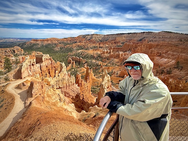
Sunrise and Sunset Points are adjacent to each other and very popular due to their proximity to the Visitor Center and park entrance. It was bitterly cold with the high temperature never exceeding the mid-thirties and winds howling across the hoodoos at 25-50 miles per hour.
Yovimpa Point is the last in the series of incredible overlooks off the main spine road that snakes through the Park. We spent an entire day veering off into all the lookout points to take in as much of the park as possible.
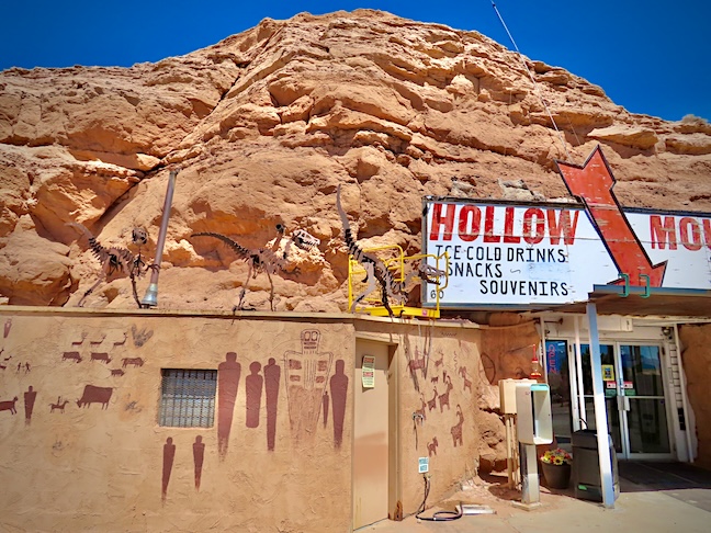
Scenic Byway 12 was our route to Moab from Bryce Canyon and lived up to its ranking among the top 10 scenic highways in the US for natural and man-made wonders. Hollow Mountain was a cool store and gas stop inside a giant carved-out rock formation.

Behind the Hollow Mountain store in Hanksville were massive red cliffs cut away by wind and water erosion to expose the thousands of years old layers of compressed sandstone with magnificent swirling patterns.
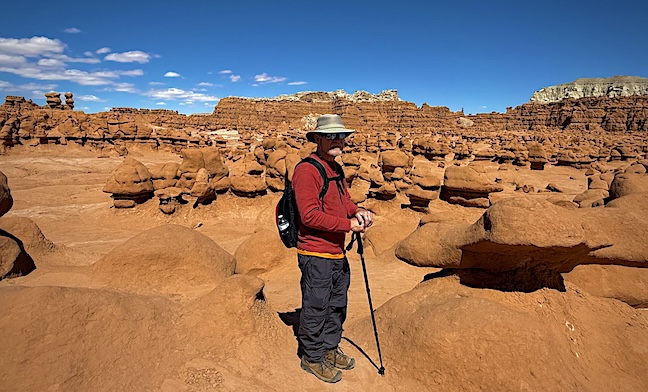
This is the first of three large valleys in the 9,915-acre Goblin Valley State Park, filled with over 10,000 sandstone “goblins” or “hoodoos” standing from five to sixty feet tall.
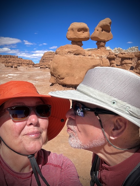
There are no designated trails among the maze of sandstone masterpieces. Hikers are free to wander among the formations, which change in shape and image as you walk around them, like clouds; everyone sees different resemblances in the red giants.
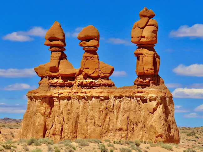
Standing alone like sentinels at the entrance to the Goblin Valley parking area are the “Three Sisters.” The tallest is 1,000 feet high.
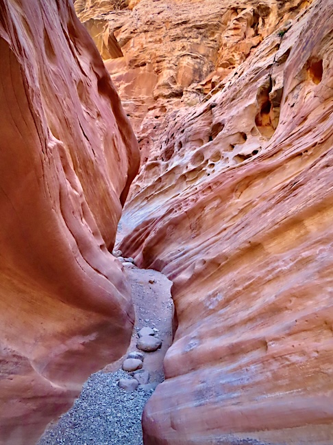
Just outside Goblin Valley is Little Wild Horse Canyon, dubbed one of the most thrilling slot canyons in Utah. The curving, polished, scooped-out walls grow closer together the farther you go into the 8.1-mile loop hike.
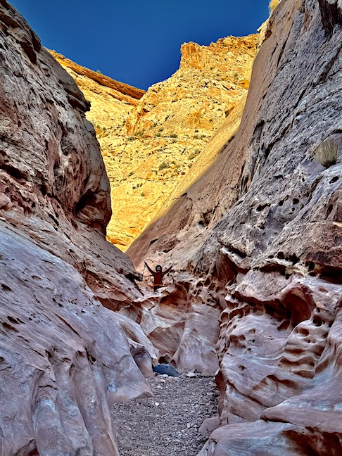
Slot canyons can be extremely dangerous. You must make certain that there are no heavy rains in or anywhere near the area before entering the curly crevices of any water-carved slot canyon. The payoff is mind-altering.
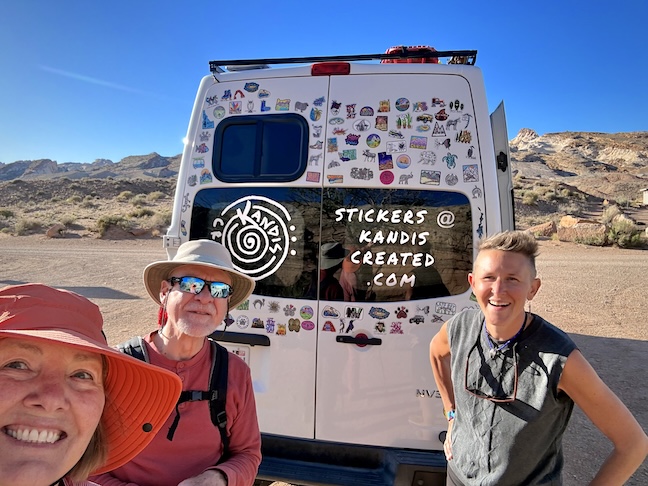
On the hike out of Little Wild Horse Canyon, we met the intrepid artist and hiker Kandis. She creates stickers for a living and told a heartfelt story about a teenage boy who believed in “Living your best dash,” before passing from an anesthetic accident in a dentist’s chair. Your dash is the time you have between birth and death on your tombstone.
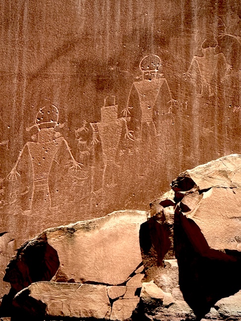
These petroglyphs were a roadside attraction on the way to Capital Reef. I always marvel at the similarity between petroglyphs that I’ve encountered all over the world.
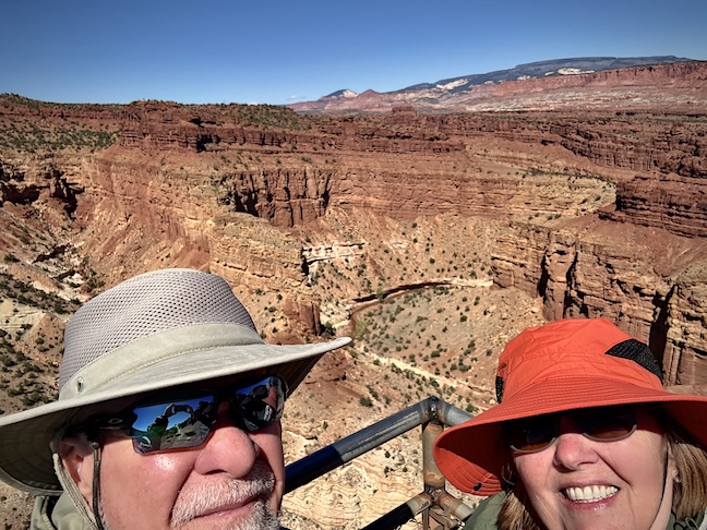
Goosenecks State Park delivers impressive views of the San Juan River snaking its way to Lake Powell in a 1,000-foot deep curving canyon.
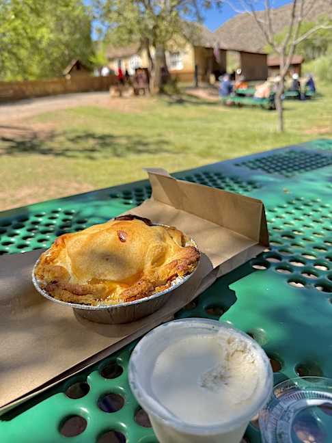
By the time we reached Capitol Reef National Park, we were hot and hungry. Near the park’s visitor center is the Fruita Historic District and the Gifford homestead, built in 1908. They make delicious pies from the apples, peaches, cherries, pears, and almonds they grow on 200 acres.
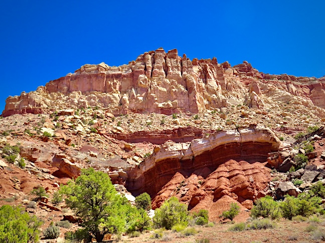
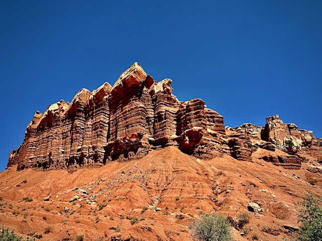
Capitol Reef is 60 miles long and 6 miles wide. It was originally dubbed “Wayne’s Wonderland” in the 1920s. The Fremont River created the steep and craggy Waterpocket Fold highlighted here. like an ocean reef, it’s a rocky obstruction to travel.
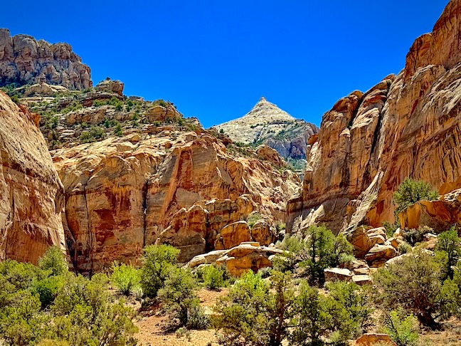
The outlaw Butch Cassidy often hid out in this area. The white-topped peak in the background above is wistfully named “Fern’s Nipple” after one of Butch Cassidy’s girlfriend’s favored attributes.
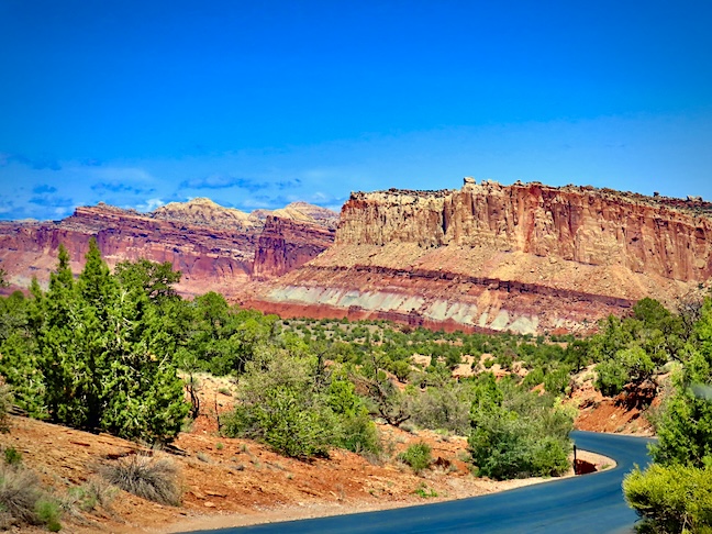
The Capital Reef’s buckle in the earth’s crust is 65 million years old. Newer and older layers got folded over each other during a crashing together of continental plates, creating the cliffs, domes, and contrasts in color.
The tower and rock layers of Capitol Reef were considered impassable by early settlers. The multihued canyons, ridges, buttes, monoliths, cliffs, and formations found here should definitely be on your itinerary when traveling in this region. This state should be named, “U-AWE!”